Satellite image of north eastern Chile showing the site and naming some mountains. (1.8 Mb map) |

Joe Tufts's amazing picture looking toward the north from Honar's summit. (75 Kb) |

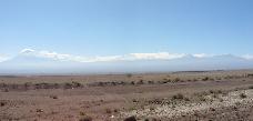
Panorama from the road heading into San Pedro. Licancabur is the prominent peak left of center. The site is to the right of that. (150 Kb panorama) |

Zoomed panorama from the same place. Licancabur and Juriques Volcanoes are on the left. Cerro Toco and Chajnantor are left of center. Volcano Lascar is on the right. (190 Kb panorama) |

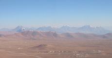
A view of the site from the eastern edge of San Pedro de Atacama looking up at the site. The peaks rise about 10,000 feet above the town. It takes around 1 1/4 hours to drive to the site (3/4 hours to drive back). Licancabur is on the left, Toco is in the the middle, Cerro Negro is right of center and Honar is on the right. |

View to the east from la Laguna Chaxis, a spot favored by flamingos. The ground is all a thin salt crystal crust floating on subsurface water. Licancabur is near the left edge, Lascar is near the center. (320 Kb panorama) |

The first day at the site. From near the containers looking at Chajnantor, Chascon, and the Caltech CBI. (250 Kb panorama) |

Looking at Toco, Chajnantor, and Chascon while setting up on Chico. Note the clouds. The heavy snow day came next.... (125 Kb panorama) |

Two days after the heavy snow looking northeast from Honar. Licancabur, Juriques, and Toco are on the left. Chico is the bump just left of Toco. Chajnantor is in the center (less snow covered) and Chascon (flanks clear) is on the right. Pampa la Bola, where the Japanese have set up an antenna at 4500m, is the clear region between Chajnantor and Chascon. (300 Kb panorama) |

The day after the heavy snow looking south across the plateau from the flanks of Toco. I think Chajnantor is rising on the left, but I'm not certain after that. We were trying to drive to the Toco bowl this day and only got as far as the Playa, well below the old mine buildings. There were about 8 in (20 cm) of snow at this point and it hadn't drifted yet. We climbed up a ridge from the playa to see the snow. (100 Kb panorama) |

From the summit of Toco, 18,387 ft (5604m), looking south across Chico (little bump), toward Honar, and beyond to Lascar and others. This is less than a week after the heavy snow. We still couldn't drive to the Toco bowl or the summit of Honar even with chains because of drifts. The hike from just past the old mine buildings was great. (150 Kb panorama) |

Looking south from the summit of Honar (17,635 ft, 5375m). The active volcano Lascar is smoking left of center. On the right, are a series of 3 6000m peaks down to Socampa(?); those aren't all clouds. (130 Kb panorama) |

View of La Valle de la Luna outside San Pedro de Atacama. The white stuff is salt. Note the clouds; we got a bit of rain that day. (200 Kb panorama) |